NOTICE
Spring is about to arrive, and we have many projects in the works. Please drive safe, especially through work zones. Happy Spring!
MAIL US
101 W. Main St.
    Courthouse
    St. Clairsville, Ohio 43950
CALL US
740 699 2160
     740 699 2161
     (deeds & tax maps)
FAX US
740 695 8894
Menu
Menu
  • HOME
  • COUNTY
    • Government
      • Belmont County
      • Departments
      • Auditor
      • Recorder
      • Building codes and zoning
    • Snow Emergency
    • Surveyors
      • Baseline Information
      • Benchmark Information
      • USGS Quad Maps 1901-1903
    • Township Trustees
    • TID (Transportation Improvement District)
    • Villages & Cities
    • Zoning
  • MAPS
    • Coal Maps
    • County Maps
      • 1888 Atlas
      • 1910 Farm & Coal Lands
      • County Road Speed Zones
    • Map Requests
    • Road Record Books
      • 1800s
        • Green 1 1803-1830
        • Volume A 1804-1823
        • Black 4 1826-1843
        • Red 2 1830-1855
        • Book 2 1857-1866
        • Blue 3 1858-1875
        • Black 1 1876-1898
        • Black 2 1878-1881
        • Book 3A 1892 – 1900
        • Black 3A 1893-1900
      • 1900s
        • Book 4 1902-1907
        • Black 5 1907-1914
        • Red 9 1922-1928
        • Book 7
        • Book 8
        • Book 9
        • Book 10
        • Book 11
        • Book 12
        • Book 13
        • Book 14
        • Book 15
      • 2000s
        • Book 16
        • Book 17
        • Book 18
    • Road Record Index Maps
  • PERMITS
  • RESOURCES
    • Bridge the GAP Ohio
    • Conveyance Standards
    • FAQ
      • Children At Play & Hidden Drive Signs
      • Mailbox Installation
      • Road & Right-of-way laws
    • Speed Zone Regulations – ORC 4511.21
    • Subdivision Regulations
  • QUICKLINKS
    • Belmont County GIS
    • CEAO
    • ODNR
    • ODOT
    • Ohio - State of
    • Ohio Society of Professional Engineers
    • Professional Engineers & Professional Surveyors
    • Professional Land Surveyors of Ohio
CLOSE

1888 Atlas

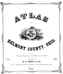
These are scanned PDF images of the Belmont County, Ohio Atlas which was published in 1888.


Acer
Barnesville
Barton
Bellaire Fifth Ward
Bellaire First Ward
Bellaire Second Ward
Bellaire Third Fourth Wards
Belmont
Belmont Ridge
Boston
Bridgeport
Brookside
Burlington
Centreville
Colerain
Colerain Town
Cover Page
East Richland
Fairmount
Fairpoint
Farmington
Florence
Flushing
Glencoe
Goshen
Great Western
Hendrysburgh
Holloway
Hunter
Industry
Jacobsburg
Kirkwood
Lloydsville
Martins Ferry First Ward
Martins Ferry Second Third Wards
Maynard
Mead
Morristown
Mt Olivet
New Castle
New Pittsburgh
Ohio
Ohio Map
Outline Plan of Belmont County
Patrons COL-PEA
Patrons PUL-SMI
Patrons SOM-YOR
Pease
Pleasant Grove
Population Counties AL-KY
Population Counties KY-TN
Population Counties TN-WY
Population US Cities
Powhattan
Pultney
Quincy
Richland
RockHill
Senators Reps Other
Sewellsville
Shepherdstown
Smith
Somerset
Somerton
Stat1
Stat2
Stat3
Stat4
Stat5
Stat6
Stat7
St Clairsville
Steinersville
Table of Contents
Table of Distances
Temperanceville
Union
Uniontown
US
US Map
Warren
Washington
Wayne
West Brooklyn
West Wheeling
Wheeling
World
WorldMap
York

Road & Bridge News

Office Hours
Belmont County Engineer
Opening Hours
Monday 8:30 AM – 4:30 PM
Tuesday 8:30 AM – 4:30 PM
Wednesday 8:30 AM – 4:30 PM
Thursday 8:30 AM – 4:30 PM
Friday 8:30 AM – 4:30 PM
Saturday Closed
Sunday Closed
Current Forecast
Copyright © 2022 Belmont County Engineer - All Rights Reserved